Welcome to Nerxon GNSS, a versatile and state-of-the-art application designed to streamline your surveying and geospatial tasks. Developed with advanced technology and a user-friendly interface, this application offers an array of multi-functional tools that support efficient data collection, management, and analysis for professionals in the surveying, engineering, and geospatial industries.
I designed and developed this application to provide users with a seamless experience while incorporating the most innovative technologies for precise measurements and advanced calculations. Whether you’re on-site, in the field, or at the office, Nerxon GNSS offers everything you need to achieve accurate results and streamline your workflow.
Key Features & Services:
Augmented Reality (AR)The AR feature allows users to visualize 3D point coordinates in real-time by overlaying them on the real-world environment through a live preview. This integration of Augmented Reality makes it easier to interact with your data directly in the field, improving accuracy and efficiency when capturing and analyzing measurements.
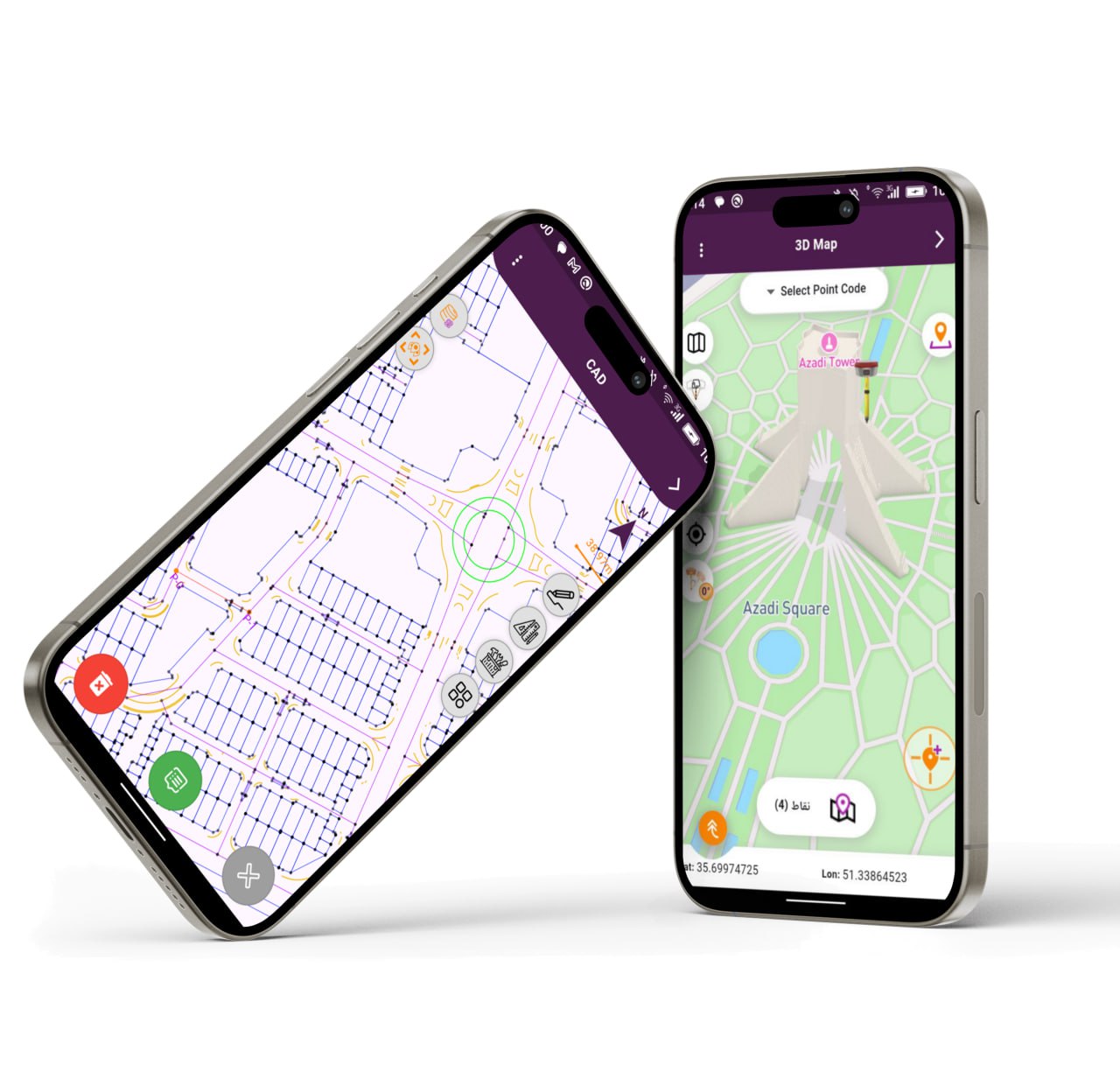
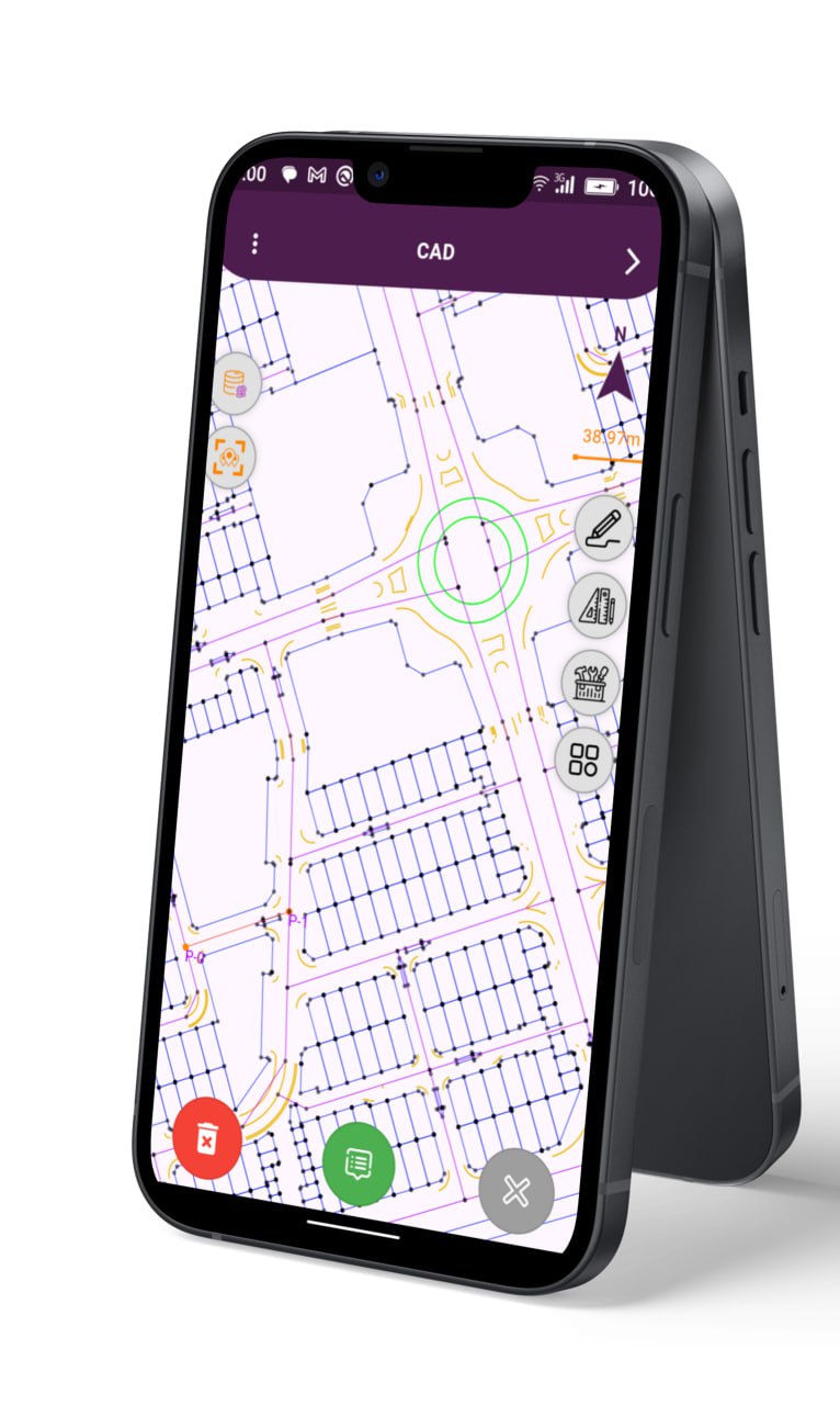
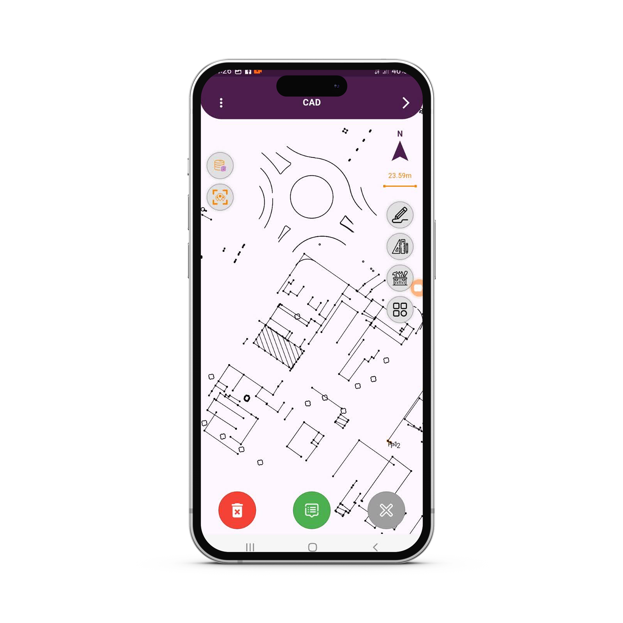
AutoCAD Integration
Create precise 2D drawings with the powerful AutoCAD tool built into the app. This feature allows users to add text, annotations, and detailed measurements, making it the perfect tool for documenting and communicating your surveying results.
Satellite Map View
Display both online and offline satellite maps to manage and preview collected datasets and existing locations. This feature enhances you ability to navigate and visualize the terrain, allowing for efficient decision-making and data analysis in remote areas.
COGO (Coordinate Geometry)
The COGO (Coordinate Geometry) tool provides an advanced engineering calculator that helps users determine points, calculate distances, and angles using mathematical formulas. This tool simplifies complex surveying calculations, making the process quicker and more accurate.
Interactive User Interface (UI)
Designed with user experience in mind, the interactive UI ensures that the application is both intuitive and easy to use. The app’s structure offers efficient navigation, enabling users to focus on their tasks without unnecessary complexity.
Additional Key Features:
Responsive UI
Built with Flutter, the application offers a responsive UI that adapts to various devices, ensuring a seamless experience whether you’re using a tablet in the field or a desktop in the office.
Data Transfer Protocol (Wi-Fi, Bluetooth, Internet)
Easily transfer data between devices using Wi-Fi, Bluetooth, and internet-based transfer. This multi-protocol support ensures efficient and reliable communication, even in remote or challenging environments.
Custom CAD with Flutter’s CustomPaint
The app integrates a powerful CAD tool developed using Flutter’s CustomPaint. This allows for the creation of detailed, customizable 2D drawings with precise control over design elements like lines, shapes, and annotations, all within a user-friendly environment.
Data Storage & Database Integration
Store your collected data securely in a local database, ensuring all your measurements, coordinates, and drawings are consistently saved and easily accessible for future use. The app ensures smooth data management and organization for any project.
Map and Survey Calculations
The app includes map and survey calculation features, allowing you to manage locations and perform essential calculations, all within a single platform. This feature streamlines your workflow, making it easier to handle large datasets and complex measurements.
Matrix Calculation
Solve complex surveying and engineering problems with the matrix calculation feature. This tool is ideal for performing advanced mathematical operations involving coordinates, distances, and angles, making your calculations faster and more accurate.
PDF Generator for Maps & Reports
Generate high-quality PDF reports of your maps, coordinates, and measurements, ready to be shared with clients, stakeholders, or used for documentation purposes. This feature ensures that your work is presented professionally and can be easily archived or distributed.
3D Mapping View
The 3D mapping view allows you to visualize your data in a three-dimensional space. This feature provides a more realistic representation of the surveyed area, helping you better understand its layout and design from multiple perspectives.
Photogrammetry UI Handling
For projects involving photogrammetry, the app includes an intuitive UI for handling 3D models and imagescaptured during fieldwork. This feature allows you to analyze and manipulate spatial data captured through photographs, providing you with valuable insights for detailed measurements.
Why Choose Nerxon GNSS?
The Nerxon GNSS Application is designed to deliver precision, efficiency, and ease of use for surveying, engineering, and geospatial professionals. Whether you are working in the field or the office, the app provides you with all the tools you need to get the job done right, from data collection and transfer to advanced calculations and map creation.
As the developer of this application, I specialize in Flutter development and GNSS technologies, delivering solutions tailored to the needs of professionals who require reliable, high-performance tools. With a focus on customization, innovation, and cutting-edge technologies, I am committed to helping you achieve your project goals with ease.
If you’re looking for a powerful, all-in-one solution for surveying, mapping, and GNSS device integration, Nerxon GNSS is the tool you need. Let’s discuss how I can help bring your project to life with advanced technology and expert development.